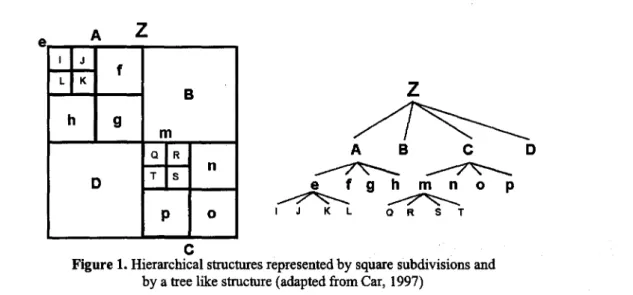
Hierarchical Spatial Reasoning Applied to Spatial Data Infrastructures
Texto completo
Figure


Documento similar
In order to test the significance of the spatial distribution, we estimate a spatial model explaining the value of agri-food companies in function of
To investigate the role of each of these different explanatory factors, the concept of civilian supremacy is introduced as my explanandum, broadly defined as the extent and nature
The main contribution of this work is three-fold: 1) a comprehensive spatial statistical analysis is developed in order to facilitate a better understanding of the evolution of
Determinants of disability prevalence: an empirical spatial analysis 4.1 Exploratory analysis of spatial data on the disability rate in Morocco The objective of this section is
Method: This article aims to bring some order to the polysemy and synonymy of the terms that are often used in the production of graphic representations and to
In the “big picture” perspective of the recent years that we have described in Brazil, Spain, Portugal and Puerto Rico there are some similarities and important differences,
A naive expectation would have been that the pinch-off of a bubble in water is governed by the same scaling laws as the "inverse" case of a drop of water pinching off in
Spatial analysis of health events (spatial epidemiology) is a discipline that, despite still being in the development phase, can already claim its own domain in the field of
